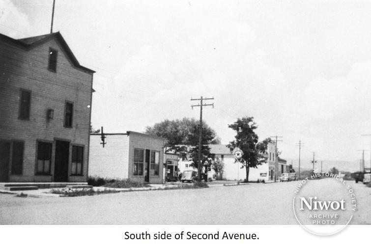
To provide a perspective, or ‘map’, of Niwot’s 2nd Avenue as I recall in the mid 1960’s, here is a description of the businesses that were there. This street was lined with shops, homes, and small businesses.
At the West end of the street, on the South side, was the remains of the former lumber yard and hardware store. The West half of the building was dilapidated; the East half was the Left Hand Water User’s office. Across Murray Street to the East was the Columbine camper manufacturing company. Back then, this was a popular type of business. Then there was a small gap between buildings and Earl Knaus’s grocery store (currently the 1914 House). Adjacent to the store was a circle drive and an old garage and storage building where Earl stored his vehicles. Next was an alley, and then Mrs. Burlington’s home offset from the street with a large yard. Smitty’s Antiques building was next with a drive between it and the Left Hand Grange.
Continuing East, across Franklin Street there were three or four residences (the feed store hadn’t been built yet). At the intersection of 2nd Avenue and Niwot Road was Lubavitch’s (sp?) Gas station, garage, and café.
On the North side of 2nd Avenue from Niwot Road and West to Franklin Street were residences, no businesses were there yet.
At the Northwest corner of 2nd Avenue and Franklin was the empty Niwot Tribune building. Abutted to it was Curtis’s Drug Store, garage, and gas station. A narrow strip of land separated the garage from the Livingston Hotel. At the end of that strip, just behind the hotel was the “Fire House” building. Next to the hotel was a large empty lot and then a cinder-block building, Niwot Auction house. Next to it was Walt Atkinson’s Blacksmith shop, with two attached buildings next to it, which was Nita’s café. An open lot with an old structure was recessed next to the alley and the Niwot Post office was on the Northeast corner of 2nd Avenue and Murray.
West, across Murray Street was a beautiful park with gazebo, maintained by some of the local ladies. Furthest West there were three railroad tracks: the mainline to Boulder, a passing track, and a spur, probably a remnant of the sugar beet dumping ramp.
In the mid 1960’s, several businesses and residents collected funds to have 2nd Avenue paved. I don’t believe there’s a record of this within Boulder County records as it was privately funded. I remember that Mr. Curtis, owner of the Drug Store and gas station, wouldn’t contribute. Hence there was a gravel patch that marred the otherwise paved street in front of the drug store.
The Hicks family lived in a mobile home right behind the Water User’s office, next to the railroad tracks. There is still evidence of our front yard by the trees and lawn that are still there across from the current Post Office. None of the streets were marked with street signs. As an 8-year-old with a curiosity about the town, I would ask the old timers the names of the streets, including the one I lived on. The standard response was “What does it matter”. I didn’t learn the name of my home street until after I had moved away.

